About Us
Visit
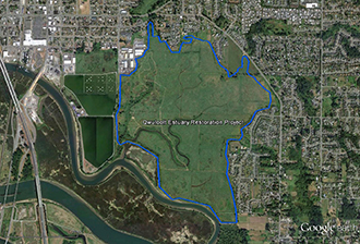
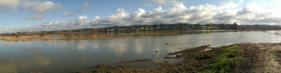
The Qwuloolt Estuary lies within the Snohomish River floodplain, adjacent to Ebey Slough and three miles upstream from its outlet into Puget Sound. The project area is located in Marysville, Washington on lands held in trust for restoration.
To visit by land
Harborview Park is located on the eastern side of the Qwuloolt. Drive east on 4th Street from Interstate-5, turn right on State Street, left on 3rd St/Sunnyside Blvd, and right on 52nd St, which becomes 60th Avenue NE. A small parking lot for Harborview Park will be on the right. A trail meanders north and south from the parking lot along the edge of the estuary.
Harborview Park
To visit by water
Ebey Waterfront Park boat launch is located a mile downstream on Ebey Slough. Drive east on 4th St from Interstate-5, turn right on State Street, and right on 1st St. The boat launch is on your immediate left and is open dawn to dusk.
Ebey Waterfront Park
Use the Snohomish Estuary Map
produced by Snohomish County Parks and Recreation to visit many sites within the estuary.